Government of Brazil advances in the demarcation of ten Indigenous lands
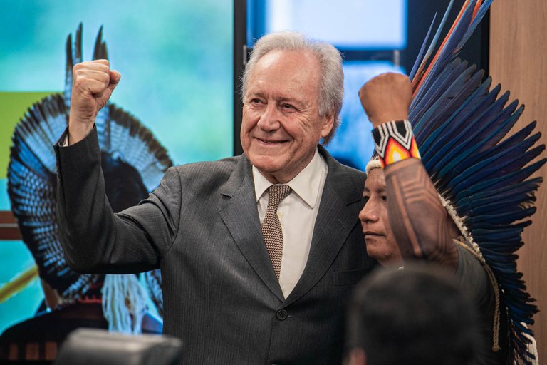
The measure was formalized by the Minister of Justice and Public Security, Ricardo Lewandowski, on Indigenous Peoples’ Day at COP30
By the Secretariat for Social Communication of the Presidency
The Government of Brazil announced the demarcation of ten Indigenous lands on Monday, November 17, Indigenous Peoples’ Day at COP30. The ordinances were signed by the Minister of Justice and Public Security (MJSP), Ricardo Lewandowski, in coordination with the Ministry of Indigenous Peoples (MPI).
Among the territories is Tupinambá de Olivença (BA), whose demarcation had been promised during the ceremony marking the return of the Tupinambá Cloak—an artifact that remained on display in a Danish museum for 300 years and was repatriated to Brazil last year.
The measure also encompasses the following territories: Vista Alegre (AM), Comexatiba – (Cahy-Pequi) (BA), Ypoi Triunfo (MS), Sawre Ba’pim (PA), Pankará da Serra do Arapuá (PE), Sambaqui (PR), Ka’aguy Hovy (SP), Pakurity (SP), and Ka’aguy Mirim (SP). These areas are inhabited by the Mura, Tupinambá de Olivença, Pataxó, Guarani-Kaiowá, Munduruku, Pankará, and Guarani-Mbya Indigenous peoples.
Process — The demarcation ordinances represent institutional recognition of the right to Indigenous lands and the definition of territorial boundaries. The demarcation process unfolds in successive stages requiring administrative acts by the National Foundation for Indigenous Peoples (Funai), the Ministry of Justice and Public Security (MJSP), and the Presidency of the Republic of Brazil. The final decision lies with the President, who, through a decree, grants the definitive title of the Indigenous land to the respective community.
Recognition — In 2024, through the MJSP, the Government of Brazil recognized Indigenous permanent possession over 11 territories. With the signing of the new ordinances, 21 Indigenous lands are now officially recognized. No new demarcations had occurred since 2018.
Currently, Indigenous lands encompass 117.4 million hectares, or approximately 13.8% of Brazil’s territory—areas that include some of the largest continuous tracts of tropical forest on the planet. A study by the Articulation of Indigenous Peoples of Brazil (Apib), the Amazon Environmental Research Institute (IPAM), and the Indigenous Climate Change Committee (CIMC) indicates that expanding demarcations could prevent up to 20% of additional deforestation and reduce carbon emissions by 26% by 2030.
The ten demarcations encompass diverse peoples, biomes, and regions, strengthening climate protection, sociocultural diversity, and environmental justice. They reaffirm Brazil’s commitment to an evidence-based climate agenda aligned with global goals discussed at COP30 and with the demands of Indigenous leadership, who remain at the forefront of environmental protection.
Tupinambá — Located among the municipalities of Ilhéus, Buerarema, and Una, in the state of Bahia, the Tupinambá de Olivença territory is inhabited by the people of the same name. The demarcated area covers 47,374 hectares and is home to 4,631 people, according to the most recent assessments. It overlaps with the Ipiranga Settlement Project (PA Ipiranga), where most residents are Indigenous.
This territory was pledged during the ceremony marking the return of the Tupinambá Cloak, which had remained on display in a museum in Denmark for 300 years before being repatriated to Brazil last year. This sacred and rare Tupinambá artifact was taken to Europe in 1644 and remained there until July 2024. The cloak measures approximately 1.20 meters in height and 80 centimeters in width. Considered a sacred entity by the Tupinambá, it is crafted from the red feathers of scarlet ibises and the plumage of parrots and blue-and-yellow macaws.
Vista Alegre — In the state of Amazonas, within the municipalities of Careiro do Castanho and Manaquiri, lies the Vista Alegre Indigenous land, inhabited by the Mura people. The recognized area encompasses 13,206 hectares. In 2008, the Indigenous population was estimated at 160 individuals. The territory partially overlaps with the Castanho Agroextractive Project, administered by the National Institute for Colonization and Agrarian Reform (Incra), and includes 39 non-Indigenous settlements.
Comexatiba — In the municipality of Prado (BA), where the Comexatiba – (Cahy-Pequi) territory is located, lives the Pataxó people. The demarcated area covers 28,077 hectares and is home to 732 Indigenous residents. The territory overlaps with the Discovery National Park, a federal conservation unit, and with the Cumuruxatiba Settlement Project, under Incra’s management.
Ypoi Triunfo — In Paranhos (MS), the Ypoi Triunfo Indigenous territory encompasses 19,756 hectares and is home to 869 Indigenous residents, according to 2009 data from Funai. The area also includes a Settlement Project inhabited by 68 families.
Sawre Ba’pim — The Sawre Ba’pim Indigenous land, in Itaituba (PA), spans 150,330 hectares and is home to the Munduruku people. The area includes 62 recorded occupations, one of which is a registered property, while the others are recognized as holdings. The territory overlaps 78.59% with the Amazon National Park, a federal conservation unit of full protection, and partially with the Santa Cruz Gleba (5.68% of its total area), certified by Incra.
Pankará — In Pernambuco, in the municipality of Carnaubeira da Penha, lies the Pankará da Serra do Arapuá Indigenous land, inhabited by the Pankará people. The territory covers 15,114 hectares and is home to 4,716 Indigenous residents.
Sambaqui — Located in Pontal do Paraná (PR), the Sambaqui Indigenous land is inhabited by the Guarani-Mbya people. The demarcated territory spans 2,798 hectares and is home to 31 residents.
Ka’aguy Hovy — In Iguape (SP), the Guarani-Mbya people live within the Ka’aguy Hovy Indigenous land, located in the Vale do Ribeira, which, together with São Paulo’s coastal zone, contains the largest remaining continuous area of Atlantic Forest in Brazil. The demarcated area covers 1,950 hectares and is inhabited by 90 Indigenous residents. The territory lies entirely within the Cananéia-Iguape-Peruíbe Environmental Protection Area (APA). In 1998, the Vale do Ribeira was designated by UNESCO as a World Natural Heritage Site.
Pakurity — In the municipality of Cananéia (SP), the Pakurity Indigenous land, inhabited by the Guarani-Mbya people, covers 5,730 hectares and is home to 133 Indigenous residents, according to 2016 data from Funai. The area partially overlaps with the Ilha do Cardoso State Park.
Ka’aguy Mirim — Also in São Paulo, within the municipalities of Miracatu and Pedro de Toledo, the Ka’aguy Mirim Indigenous land, inhabited by the Guarani-Mbya people, spans 1,190 hectares and is home to 70 Indigenous residents. It is located in the Vale do Ribeira, which, together with the coastal zone of São Paulo, contains the largest remaining continuous stretch of Atlantic Forest in Brazil.